 |
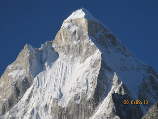
| Dhaulagiri (8167m) from Khopra Ridge. |
We spent a few weeks in Feb/March 2023 tossing around ideas for a
spring trek. This included a reprise of our 2011 trip to Annapurna Base Camp, which by
all recent accounts, looked exceedingly commercial, hence was crossed off the list. The others included the more
recently opened Mardi Himal trek, but that looked too similar to the ABC route.
Pike Peak looked interesting, but we didn’t want to risk its unknowns when
traveling with two children. We finally settled on a relatively new route
called the Khopra Ridge trek. Even though it's quite mainstream, Khopra Ridge was new
enough that our carefully preserved trekking map from 2011 had no sign of it. A little
browsing showed that tour operators are working hard to popularize it and is now
offered by several commercial outfits. Trekking infrastructure is so well
developed in Nepal that ordinarily one can hike these routes independently. But regulations passed in early 2023 mandated that all trekking groups need to be
accompanied by a government certified guide. At USD 35.00 per day, it felt a
bit steep, for its questionable returns, given the easy availability of high-quality
trekking maps, tea-houses, and well-worn trails frequented by locals.
Nevertheless, our friends from the erstwhile Sacred Valley Inn Pokhara helped
arrange a guide, porters, and permits. On Apr 3, as soon as school broke for
the summer, Ranjita, Samarth (13), Ishan (9) and I boarded the “Lumbini”, Royal
Nepal's direct service from Bangalore to Kathmandu. Prasad would join us in
Kathmandu the next morning, flying in from Delhi.
Kathmandu airport’s international terminal looked
significantly spruced up compared to my last visit in 2018 (Langtang Valley). Claiming
our bags was significantly less chaotic. Except for a slightly strange
character who insisted on inspecting our bags to make sure they weren’t his
girlfriend’s (who was nowhere to be seen), everything went smoothly. Within a
matter of minutes, we were at the basic, but convenient “Regal Airport Hotel”,
very close to the Terminal building.
 |
| Night halt in Kathmandu at the crummy but convenient "Regal Hotel" |
Day 1: Pokhara to Ghandruk (2000m)
Next morning, back at the airport, we met Prasad at the
domestic terminal, and enjoyed the early morning low-flying 20-seater Yeti
Airlines flight to Pokhara. Flying west, we enjoyed clear views of the peaks of
Central Nepal on the right. A few months
earlier, a Yeti Airlines plane had crashed while landing at Pokhara’s spanking
new airport, killing all passengers. So it was not without some hesitation that
we decide to fly in, instead of suffering the 250 km road trip.
The views from the tarmac at Pokhara were spectacular and
offer what might just be one of the best vantage points in the entire city. The
terminal built with Chinese funding appears to be something of a white
elephant, with negligible utilization of its built capacity. We read in the
news that the government of Nepal has been lobbying India to start direct
flights from Delhi and Lucknow to Pokhara. All in all, Pokhara International
Airport stands todays a symbol of Chinese influence over Nepal, alongside other
high visibility projects, such as the restoration of earthquake-hit heritage in
Kathmandu’s famed Durbar Square.
 |
| New terminal building at Pokhara Airport |
Bishnu and Ailsa, the owners of the erstwhile Sacred Valley
Inn, which used to be a lovely little home-away-from-home in Lakeside, Pokhara's tourist neighbourhood, shut
down their hotel businesses during the pandemic. Now they only focus on trekking
and tours in collaboration with the very lovely Hotel Karuna. We spent a couple
of hours there having breakfast, admiring the house turtle, waging war with
some ATM’s to withdraw Nepali currency, and repacking our stuff, before heading
out for the trails.
We left Pokhara at 11 am by jeep and drove till Kimche
(1800m), which was as far as the road would take us towards Ghandruk. As a
result, trekkers are now spared the arduous climb up the many stone-cut steps that link the valley floor with Ghandruk (they proved to be quite the challenge on the Annapurna 50K several years ago). So after lunching at the road head, it
was a leisurely hour’s walk to Ghandruk, the largest Gurung village of the area.
 |
| Traditional stone walls of Ghandruk |
 |
| "DBT" is as ubiquitous as it is delicious |
 |
| Ghandruk Tea House, with Annapurna South and Hiunchuli in the background |
Ghandruk is a beautiful collection of stone buildings, tea
houses and monasteries, offering inspiring views of Annapurna South (7200m) and
Hiunchuli (6441m) to it’s north, and Machhapuchare to it’s north east. At
6993m, Machhapuchare compensates for its 7m shortfall by its striking
appearance: it’s vertical relief topped by twin peaks that give it its name,
which translates to “Fish Tail”. Under the watch of these giants, we settled
into the very well appointed “Trekkers Inn” in Upper Ghandruk and spent the
afternoon exploring higher, less commercial parts of the village. The food was
as excellent as we remembered from prior trips: the meticulously arranged
plates of daal, bhaat, and fresh greens are an always welcoming feature of the
tea houses in this area.
Day 2: Ghandruk (2000m) to Tadapani (2600m). 6-7 km, 4.5
hours (including lunch break)
The next morning at our guide’s insistence, we took a 30 min
detour to visit and take pictures, tourist-style, of “Old Ghandruk”. As a result, we started the real hike out of Ghandruk as late as 10:30 am. The trail climbed
climb up and out of the sprawling village leaving the well-carved stone steps
behind to enter a rhododendron forest. It was a little early in the season, so
the flowers were only sporadic. Besides, unseasonal showers had damaged a lot
of the blooms in this section. At one point the trail crossed a bridge over a
mountain stream, and then climbed steeply up more steps for 30-45 min, to “Baisi
Kharka”, where we stopped for lunch amidst a light drizzle. The trail eased out
after this, and a few more miles of forest hiking brought us to Tadapani (2600m).
 |
| Old Ghandruk |
 |
| Quick rest before the climb to Baisi Kharka |
 |
En route from Ghandruk to Tadapani.
|
 |
| Ishan's depiction of Macchapuchhare and Hiunchuli |
Tadapani like Ghandruk is a Gurung village. Both lie on the
incredibly popular route to Ghorepani and Poon Hill, a much advertised beginner
route in the area that offers views of Dhaulagiri. Tadapani has expansive views to the east, including Machapuchare
and somewhat ambiguously, Manaslu (8163m), one of the three “eight thousanders”
you get to see on this trek. Annapurna South still dominates the view to the
north. Annapurna I, like on the ABC trek, isn’t visible until you reach the final destination (Khopra Ridge, in this case).
The lodge at Tadapani was a step down from the luxuries of Ghandruk, but it did
offer hot showers. Two dogs befriended us, one of which whom the kids named "Kala" had a bad cold --- he kept
sneezing through the night while curled up on the doormat outside our room, and
then again through the next morning while he kept us company on the hike.
Day 3: Tadapani (2600m) -> Dobato (3400m): 6-7 km, 6.5 hours (incl. tea and lunch breaks)
 | "Kala" was sneezing all night.
|
|
Several trekkers were up early in the morning. From the
courtyard, we all enjoyed our morning caffeine in the presence of a sublime
sunrise behind Machapuchare and the peaks further to it’s east. Even the kids and
said dog were up at 6 am to enjoy the views. We were all set and ready to go by
8 am. The hike out to Dobato was perfect. The sun was up, the rhododendrons became
more plentiful as we gained altitude.
 |
| Sunrise behind Machhapuchhaara and Manaslu (from Tadapani) |
 |
| Kala and Shweti were up and about after a difficult night |
 |
| Hiking out of Tadapani |
The forest cover started to thin,
providing unobstructed views of the big snow giants and the immense valleys
between them. The trail swung westwards, away from the Modi Khola, providing
ever changing perspectives of the massive peak of Annapurna South. After a
lemon tea break around 10 am, it was a steep climb to Isharu (3100m), where we
had an early lunch at 11:30 at a lovely tea house with a ceiling lined with
flags from all over the world. Service was slow, but we didn’t mind – the
location was simply superb.
 |
Lunch at Isharu
 | | Snow patches on the way to Dobato. |
|
 |
Last few steps to Dobato
|
After lunch the clouds rolled in. Out came the rain jackets,
and soon the trail passed through sections that had a fair amount of snow, much
to the delight of the kids. There were some tricky icy sections in the final
approach to Dobato, but the kids negotiated them quite well. We hiked past
lower Dobato and made for the final two lodges in the village. Just behind the
lodge, muddy, icy footprints marked the trail to Muldai Top, a minor local
summit similar to Poon Hill. It’s a worthwhile day hike for the enthusiastic,
but the sense I got from Prasad was that if you’re doing the rest of the Khopra
Ridge route, it doesn’t add anything significantly unique to the trek.
By now I was feeling the effects of altitude and cold a bit, hence decided to skip the next morning’s hike to Muldai Top. We settled into the
basic accommodation and spent most of our time in the warm dining room to
escape the near freezing evening temperatures outside. In spite of the
remoteness, the lodge had Wifi connectivity, and the children of the lodge
owners, like so many of their generation, were hooked to their phones for
almost all the time that we were there.
Day 4: Dobato (3400m) to Chistibang (2900m): 7-8 km, 7
hours (including tea and lunch break, and long halt at first, jaw-dropping
views of Dhaulagiri).
The morning was cloudless. The sun rose behind the eastern
range, climbing above the southern flank of the grand, but now distant
Machhapuchare. It lit up the patch work of snow and grass that surrounded
Dobato on all sides. Ranjita and Prasad made the early morning hike out to
Muldai Top where they were rewarded with excellent 360-degree views including their
first views of Dhaulagiri. As the kids slept, I enjoyed a few cups of
tea in the warm dining room, in the company of Uma Prasad Mukherjee, hiking
the Garwhal Himalaya in the 1960s.
 |
| Prasad and Ranjita hiked to Muldai Top and got their first views of Dhaulagiri |
 |
| The dining room at Dobato was the best |
We were all ready early enough, despite the trickle of water
from the frozen outdoor taps. We started hiking around 8 am, descending through
the snowy slopes of Dobato under bright blue skies. Soon we would have our last
views of Machhapuchare and the entire eastern side of the Annapurna Sanctuary.
The trail waded through rhododendron bushes, considerably shorter than the
forest we hiked through just yesterday, and soon gained a local ridge providing
new vistas to the west, with the Dhaulagiri Massif, front and center of it all.
Between 1808 and 1838, Dhaulagiri I at 8167m was actually regarded as the
highest mountain on earth, based on analysis from the Great Trigonometric Survey of India. The survey started in 1802 and later was credited with
accurately assessing the altitudes of several Himalayan giants, including
Kanchenjungha (1838) and Mount Everest (1858) and till this date, is considered
a landmark achievement in scientific study of the planet. The historic French expedition led by Maurice Herzog in 1950 resulted in the first successful ascent of an 8000m peak (Annapurna). In the early part of his famous book, he describes how they had difficulty locating the mountain, armed with hand drawn maps handed down by a prior expedition. Instead they opted to attempt Dhaulagiri, and failed spectacularly. Instructions from the French government (driven by the games nations play) were to claim "some" 8000m peak. Failing to climb Dhaulagiri, they eventually climbed Annapurna. "Annapurna, First Conquest of an 8000-meter Peak" is still regarded as a classic tale of European Himalayan exploration, though a modern conscientious reader will be disturbed by the racist references to the local people.
On this section of the trail, our guide pointed out the very
popular and crowded trail to Poon Hill in the distance, and the town of
Ghorepani. Back along the way we came, the summit of Muldai Top was very
prominent. The customary lemon tea break came at 11 at an isolated lodge
offering great views of the Dhaulagiri range. The altitude seemed to be
driving up our appetites, so we ended up downing a fair amount of noodle soup
as well. From here the trail descended steeply into the narrow valley in front of
us. The trees grew taller, the conifers reappeared, the rain came in, and we
trudged a little gloomily (except for a joyful sighting of a rhododendron tree covered
with blossoms), all the way down to a ramshackle bridge across a river at
the bottom of the valley. The trail was barricaded just after the bridge, so a
little hesitantly, we worked around the blockade, and soon climbed steeply out
of the valley, and continued a slightly tedious few kms through forest, before
arriving at Chistibang, a net elevation loss of 500m from Dobato.
 |
| One bright spot on the gloomy hike to Chistibang |
Chistibang was a slightly depressing pair of lodges in the
middle of the forest. We spent that evening and night in
more-than-usually-shabby rooms, a poorly lit dining room
with no redeeming views to be had outside. But for some reason they had the
best French fries and the worst pizza of the entire trip and one unfortunate trekker
(not among us) was violently sick all through the night.
Day 5: Chistibang (2900m) to Khopra Ridge (3660m): 4km, 3.5
hours (incl. one longish sitting break)
Happy to be leaving Chistibang, we got started at 8, under
blue skies. Within 45 min, we were clear of the forests, once again hiking
north-westwards through stunted vegetation, panoramic views of the hills to the
south, and occasional sneak peaks of the Annapurna massif behind a high ridge
immediately to our north.
 |
| Muldai Top and the last few rhododendrons as we approached Khopra Ridge |
After a couple of hours, the trail had well and truly
crossed the tree line, and swinging north, returned Dhaulagiri to
the center of attention to our left, across the Kali Gandaki valley. With a few
yaks watching us intently, we inched our way up the ridge, and finally the
trail leveled out for the last km or so. It was an easy walk as we followed the
electricity poles to Khopra Ridge. A the final right-ward swing of the trail around
a corner announced the abrupt and astounding arrival of the entire West-South-Western
aspect of the Annapurna Range. Along with Dhaulagiri to our left, Nilgiri,
Annapurna I, Annapurna South, the distant peaks of Upper Mustang came together
to make this one of the the most awe-inspiring views we had ever experienced.
 |
| Khopra Ridge |
 |
Annapurna I and South from Khopra Ridge
|
 |
| We hiked up from the lodges along the ridge, or "Samman Danda" |
Quite speechless from the impact of the sudden appearance of
the giants, in gradually worsening weather, we quietly read the sign that said
the route to Khayar Lake, a holy high-altitude lake in these parts, was closed
due to snow conditions. It didn’t disappoint us even a little bit. The trek had
given so much already. Annapurna South stood as a sharp pinnacle, completely
different from the rather shapeless but ominous mass you see from Ghandruk.
Annapurna I (8091m), only slightly more distant and to it’s left, stood over
everything else. Form this angle, looking at it from the south-west, it
appeared as forbidding as did the front-on view of its South Face, which we viewed from ABC, 12 years ago.
 |
| Annapurna I, South Face, from Annapurna Base Camp (2013) |
After lunch, we walked up eastwards along Khopra Danda. The
trail climbed gradually, reaching a rocky, snow-covered plateau. A little
further, we came upon a flat area with wide views to the south towards the
plains, and west towards Dhaulagiri. This area was strewn with chortens,
marking some sort of milestone. The kids wanted to name this part of the ridge,
and came up with “Samman Danda”, and we all studiously planted a few rocks and
pebbles on older chortens to mark our presence. By now the weather had turned
gloomy, but everyone was feeling just fabulous.
 |
| The "Samman Danda" hike |
 |
| Chortens at "Samman Danda" |
As the weather turned, we moved back to the lodge, and spent
the evening in the dining room, playing cards and chatting with other trekkers,
pouring over maps to identify peaks, and drinking various hot beverages. The evening
was cold, the food service agonizingly slow. An icy wind kept blowing through a
door that kept swinging open, and a variety of socks and towels hung unattractively
over the fireplace.
Day 6: Khopra Ridge (3660m) to Paudwar (2000m), 8.5km,
5.5 hours (including breaks for lunch and tea)
While the kids slept in, the rest of us stepped out at 5:30
am to shiver and watch the dramatic unveiling of the surrounding Himalayan giants.
In the pre-dawn glow, we checked off, from right to left, Annapurna South,
Annapurna I, Nilgiri, Tukuche, and the many peaks of the Dhaulagiri Massif. As
the sun rose, we decried the inability of our cameras to capture the moment,
each one different from another. After an hour of photographic futility, we
returned to the lodge, woke the kids, and sat outside in the sun sipping lukewarm
tea, enjoying breakfast in the company of the now-glistening surroundings.
 |
| Sunrise on Dhaulagiri from Khopra Ridge |
 |
| Nilgiri Himal from Khopra Ridge |
 |
| Morning views of the Annapurnas |
 |
| Dhaulagiri (center) and Tukuche (right) from Khopra Ridge |
 |
| Dhaulagiri and Tukuche from Khopra Ridge |
After a good 4 hours of peak viewing, we finally bade our
farewells to the views, and at around 10 am, started the long downhill hike. It
was uneventful, except for a spectacular lunch of Daal, Bhaat and Tarkari at
“Lareni Pun”, complete with Thums Up. In addition to growing the greens that
were served for lunch, the owners were growing their own weed, presumably for evening
entertainment.
We stopped for some exceedingly sour lemon tea at around 2:30, where a kindly old
lady had no idea how much to charge us. A few phone calls later she communicated
some number, and we ended up overpaying. She came after us to give us our money
back. Back among the terraced fields, we hiked into a village called Paudwar with traditional stone architecture at around 3:30 pm, and found ourselves at the humbly named “Dhaulagiri
Hotel” which had partial views of the magnificent mountain. The hotel was significantly
nicer than the last few nights --- it had real rooms with attached bathrooms!
 |
The best DBT of the entire trip, at Lareni Pun
|
 |
| Weed fields at Lareni Pun |
 |
Super sour lemon tea
|
Day 7/8/9: Paudwar to Tatopani, Day Hiking at Naurikot, Return
to Pokhara
From Paudwar it was a fast-paced hike out to the Kali
Gandaki river, which separates the Annapurna and Dhaulagiri Massifs. Separating
two 8000m peaks, according to a certain definition, qualifies the Kali Gandaki valley as the deepest gorge in
the world.
The long downhill route proved tiring for Ishan, and he took
a quick fatigue-induced tumble at one point, and had to be carried, a little ignominiously
for the last km or two. Once we hit the main road alongside the Kali Gandaki,
we tried in vain to hitch a ride from numerous northbound private vehicles.
Luckily, we finally hailed a bus, and Ranjita and Ishan were allowed to board it
to cover the last few kms of relatively flat but dusty jeep track to Tatopani.
 |
| A little before the tumble, on the way to Tatopani |
The rest of us trudged in some 30 min later, had an excruciatingly slow lunch, bade farewell to our porters, and made arrangements for onward
transport. The next few days marked a slow end to the trek. We spent two nights
at the very beautiful “Lodge Thasang Village” a few hours north of Tatopani, next to the
village of Naurikot in the Upper Mustang district. The lodge is on a ridge with
commanding views of the Kali Gandaki, and is backed by a foreshortened
Dhaulagiri. Nilgiri Himal (7061m) , across the valley, is the most imposing
peak from here. The views from the terrace of the lodge were astounding.
We all enjoyed the comforts of the extremely well-appointed
lodge, strangely enough, Japanese in its design, cuisine, and sensibilities. While
the kids stayed back to spend a day in bed playing video games, Prasad, Ranjita
and I went on a lovely day hike in the pine forests in an ill-informed and futile
search of the famous Dhaulagiri Icefall. We realized soon enough the giant icefall that we could quite
clearly see from Khopra Ridge and from the Naurikot lodge, from our current vantage point lies hidden by a high ridge separating
us from the base of Dhaulagiri. Gaining access to that area would be a multi-day
undertaking. Kalpana, a local girl who worked at the lodge was our guide for
the day hike wasn’t aware of the Icefall, but took us on very enjoyable hikes to local lakes. One was called Bhutarchho
Lake and I forget the name of the other. It also happened to be the Nepali New Year, so we came across small groups of selfie-taking,
giggly teenagers enjoying the outdoors.
The next day was the long drive back to Pokhara, through
dusty towns and back breaking roads. Pokhara provided high-quality post-trek
pizza and beer (Roadhouse Pizzeria is highly recommended) and reunions with several friends – Kanchen
and Shailesh (who had arrived to do the Mardi Himal route), Kalpana (the one
from Bangalore, not Naurikot, who just happened to be around) and Bishnu and
Ganga from Sacred Valley Inn. Prasad, Ranjita and Samarth were forced to brave
the dusty drive back to Kathmandu in a non AC taxi due to flight cancellations. Ishan, Kalpana and I had a few more days to kill before heading back to Bangalore.
 |
| The elusive Dhaulagiri Icefall, clearly seen from Naurikot |
 |
| Lodge Thasang Village |
 |
| The stay at Lodge Thasang Village was unexpectedly luxurious |
 |
| Beni, the sangam of the Kali Gandaki and Myagdi River, on the road trip back to Pokhara |
Pokhara, Kathmandu, and Closing Thoughts.
Pokhara has changed quite a bit over the years. The Lakeside
area is cleaner and is better maintained but has become significantly more
commercial than it used to be. The hike to the Peace Pagoda was not
as peaceful as it once was; but is still a good morning’s workout. During our
couple of days in Pokhara, the air was foul, thanks to seasonal crop burning in
the plains. This affected flight movements so we all suffered the long dusty
drive back to Kathmandu. Oddly, polluted Kathmandu was welcome respite – we
spent the evening in Thamel including the obligatory dinner at Fire and Ice
Pizza, which remains a trusted Thamel hotpspot. On our last day, Kalpana did her own blitz through the sights of
Kathmandu. All three of us paid a visit to exquisite Patan Durbar Square in
Lalitpur, the last of the three famed Durbar Squares that I needed to knock off
my list.
 |
| Hanging out in Lakeside, Pokhara |
 |
| Roadhouse Pizza, Lakeside, Pokhara |
 |
| Boat ride and day hike to Peace Pagoda, Pokhara |
 |
| Fire and Ice Pizza, Kathmandu |
 |
Durbar Square, Lalitpur, Kathmandu
|
Khopra Ridge is a beautiful route, with all the
ingredients of a classic Nepal tea-house trek. The relative recency of the
route means the tea houses beyond Tadapani are still relatively basic (compared
with the luxuries on offer on the Annapurna Base Camp or Khumbu area trails). But
the namastes are as warm, the Dal Bhaat Tarkari just as fresh, and the mountain
scenery and the memories they leave are as indelible as anywhere else in this unique
part of the world.
 |
| "There are other Annapurnas in the life of men" (Maurice Herzog, 1951). In our case, it was the name of the Airbus A330 that brought us back to Bangalore. |


Comments